
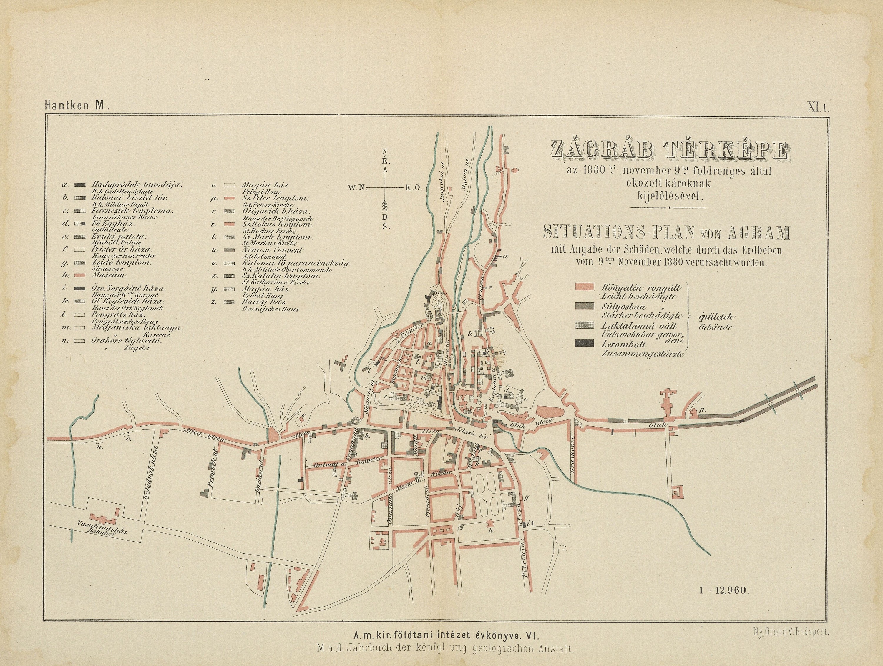
A map showing buildings in Zagreb damaged in the earthquake of 9th November 1880 (from: M. Hantken von Prudnik, Das Erdbeben von Agram im Jahre 1880, 1882). Less severely damaged structures are marked red, while those that were severely damaged are marked dark gray; uninhabitable structures are marked by a dotted line, and completely demolished ones are colored black.
[interactive map in chapter: The Academy and The Great Zagreb Earthquake of 1880]
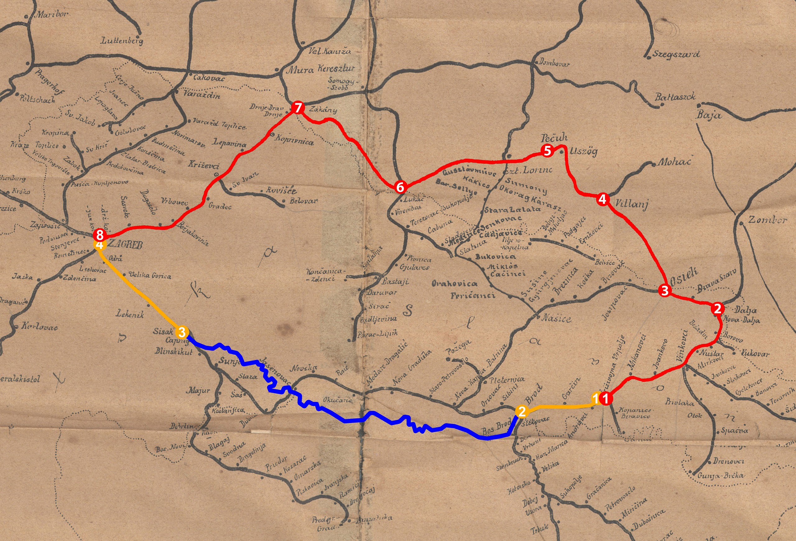
Detail of the Austro-Hungarian railway map from the beginning of the 20th century, with two outlined routes linked to the transfer of artworks from Đakovo in the summer of 1883 (property of: The Croatian Railway Museum)
[interactive map in chapter: The transfer of artworks from Đakovo in the summer of 1883]

Map of Zagreb, published in the first city guide for Zagreb, 1885 (from: Führer durch Agram und Umgebung: Nebst einem Plane der Stadt, 1885)
[interactive map in chapter: The first day of celebrations]